Grupo de Investigación de la Universidad Complutense de Madrid (ref. nº 910505) validado desde 2005.
Estaciones Experimentales: Estaciones GNSS
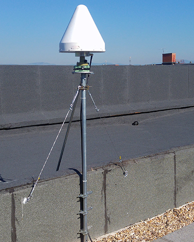
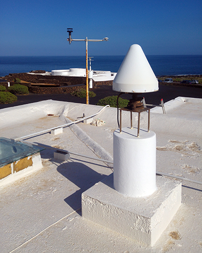
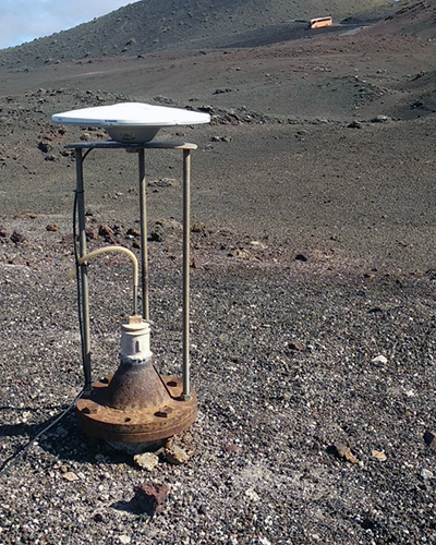
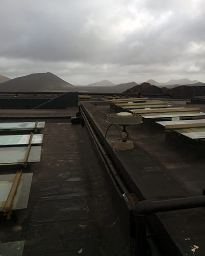
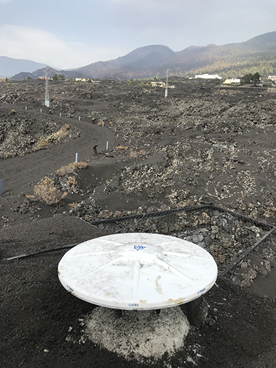
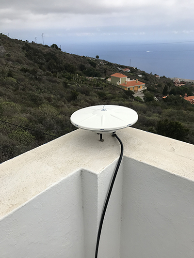
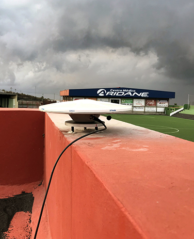
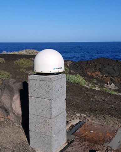
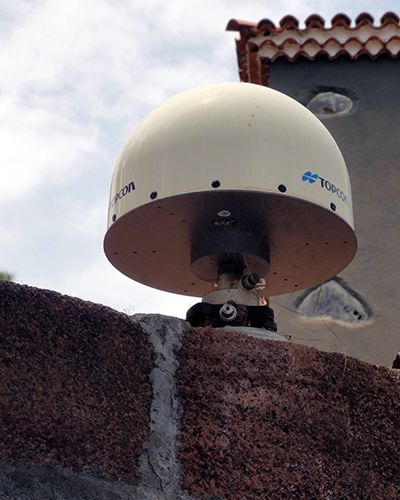
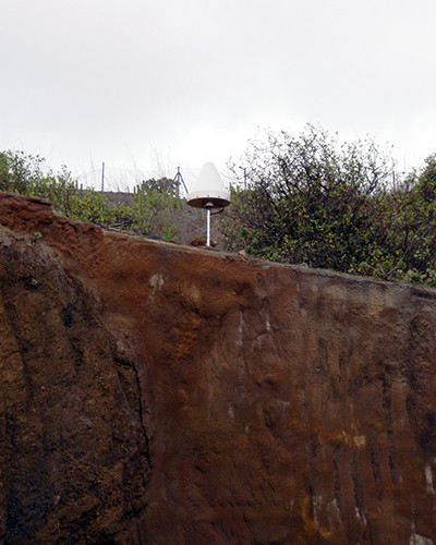
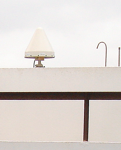
Para varios de los estudios desarrollados, nuestro Grupo ha instalado diversas estaciones experimentales, con instrumentación permanente, que nos permiten observar la actividad geodinámica de la zona. Las observaciones realizadas con las Estaciones GNSS en registro contínuo nos permite detectar variaciones en la posición a nivel subcentimétrico.
City: Las Palmas (Gran Canaria-Canary Islands-Spain)
Aprox. position
X coordinate (m): 5427096.673
Y coordinate (m) : -1505206.519
Z coordinate (m) : 2984542.516
Latitude (N is +) : +28 04 47.78
Longitude (E is +) : -15 30 04.92
Elevation (m,ellips.) : 463.68
Receiver information
Receiver Type :ASTECH UZ-12 (iCGRS)
Serial Number : IR2200440009
Antenna information
Antenna Type : ASH71945G_M
Serial Number : CR5200447019
Antenna Radome Type : SNOW
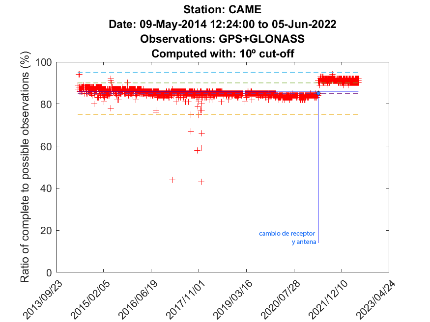
CIMB
Información de la estación
Status: Finished
Date Installed : 2010-07-08
Date Removed: 2012-10-15
Agency : GIGeodesia - IAG
Site Identification
Site Name: C.I. Mancha Blanca-Parque Nacional de Timanfaya
City: Tinajo (Lanzarote-Canary Islands-Spain)
Aprox. position
X coordinate (m): 5422423.017
Y coordinate (m) : -1322177.905
Z coordinate (m) : 3077336.004
Latitude (N is +) : +29 02 01.91
Longitude (E is +) : -13 42 11.98
Elevation (m,ellips.) : 314.42
Receiver information
Receiver Type :ASTECH Z-SURVEYOR
Serial Number : UZ120004307
Antenna information
Antenna Type : ASH71945G_M
Serial Number : CR5200447019
Antenna Radome Type : SNOW
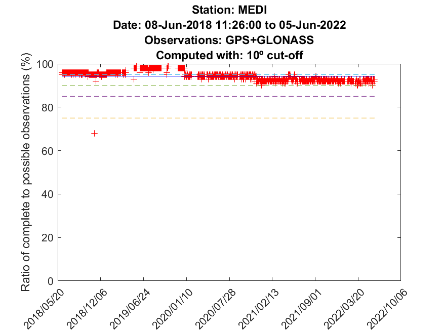
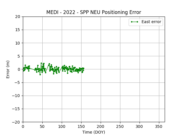
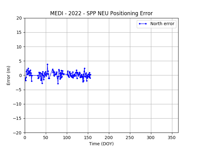
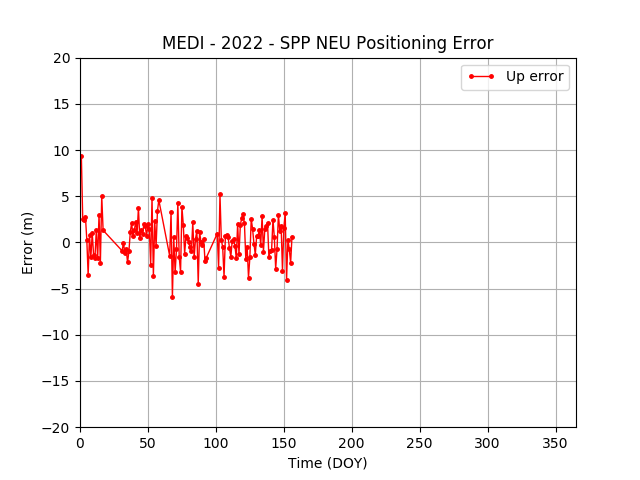
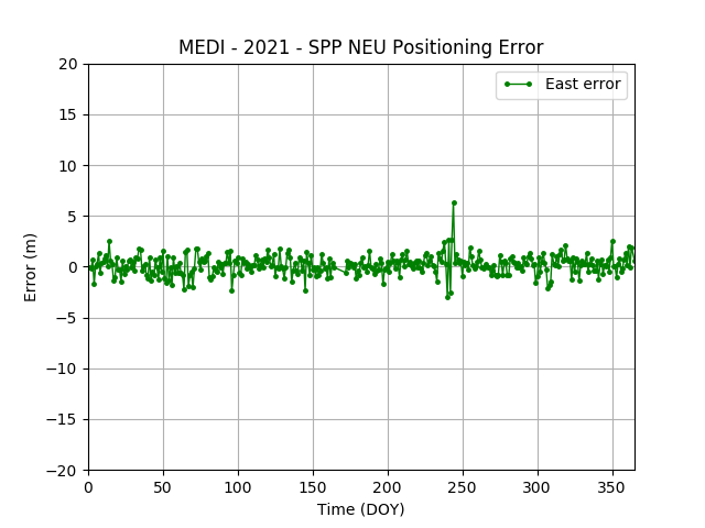
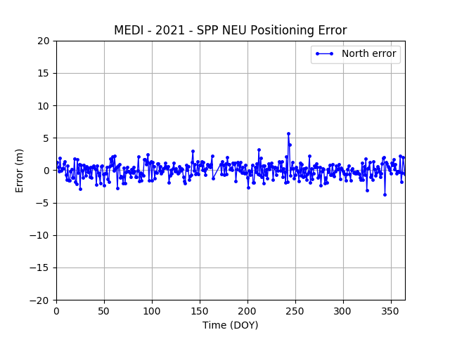
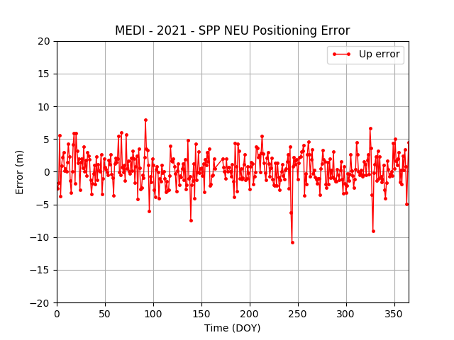
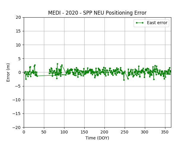
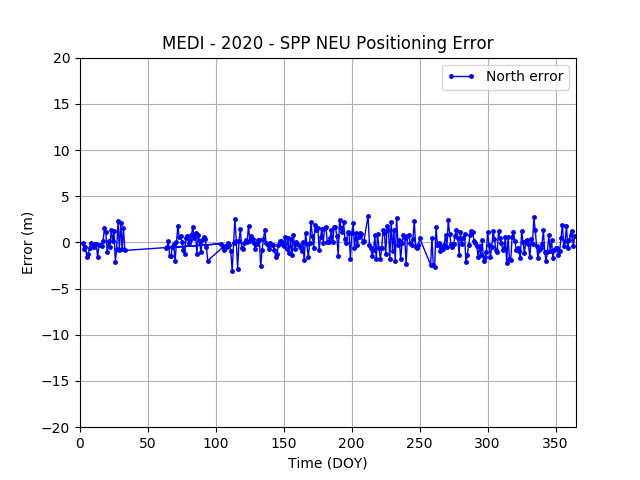
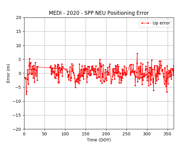
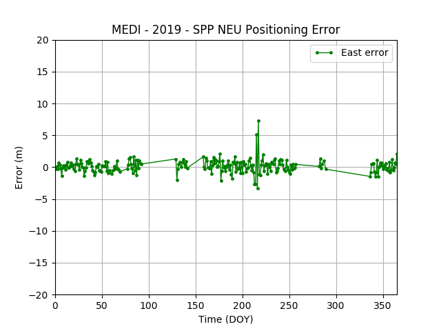
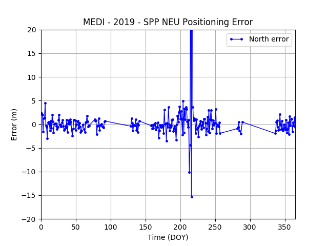
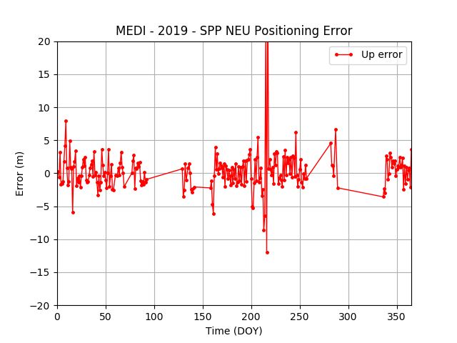
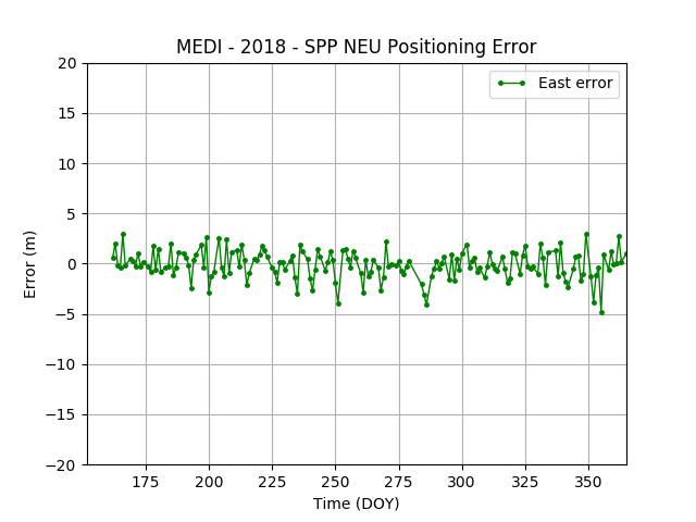
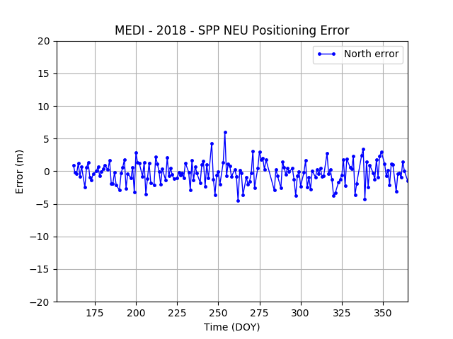
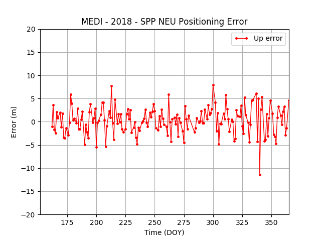
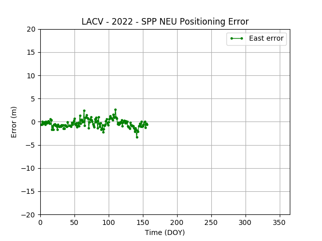
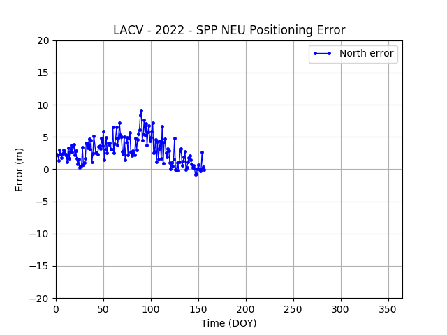
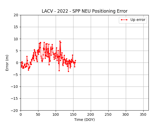
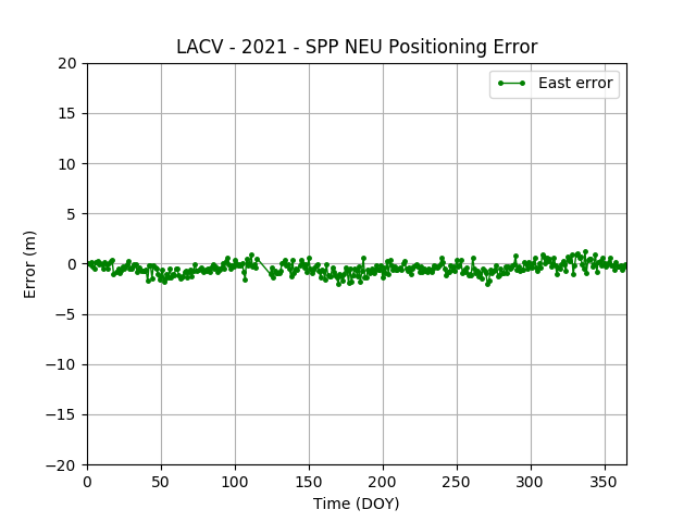
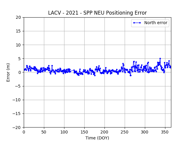
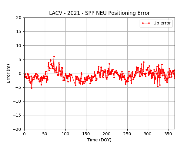
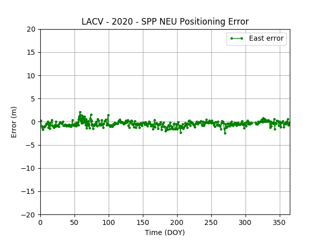
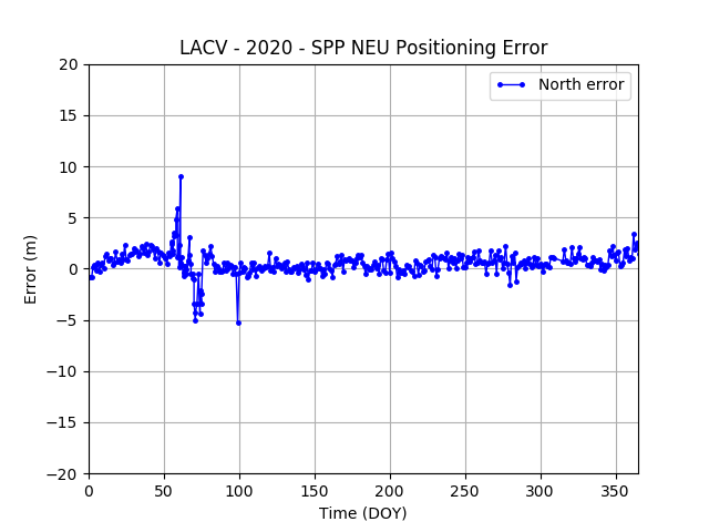
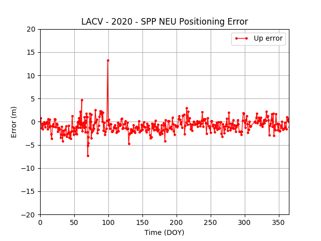
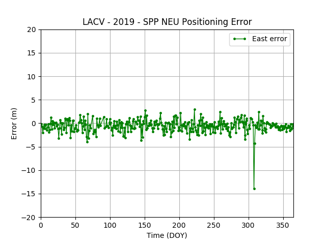
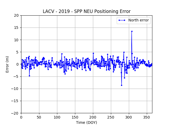
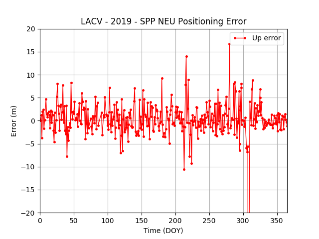
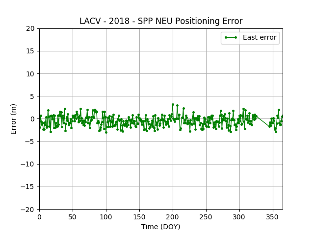
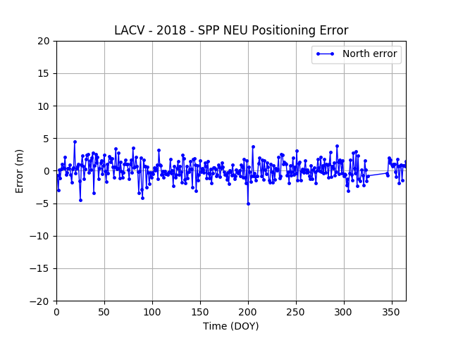
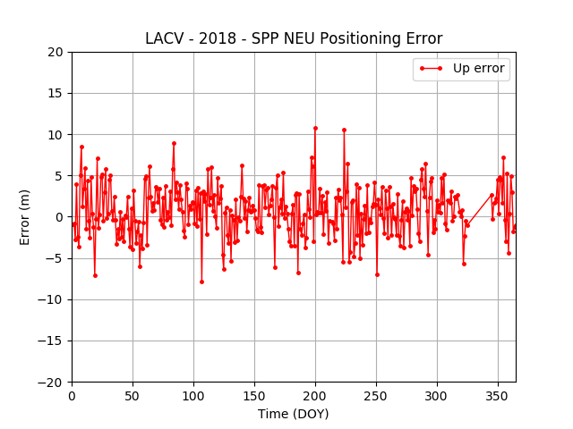
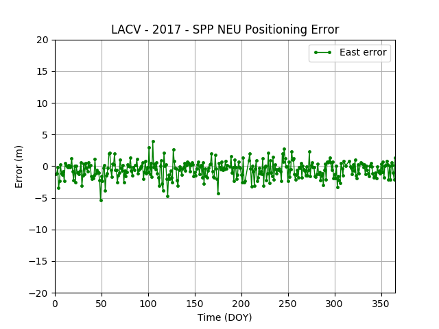
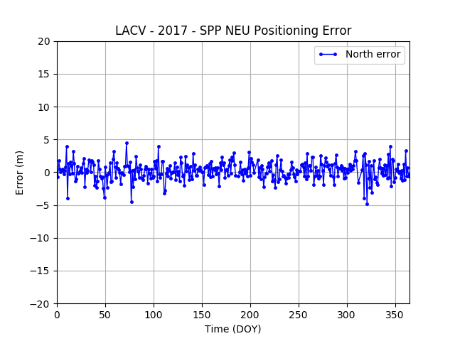
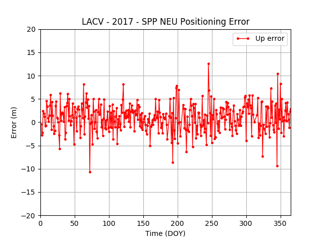
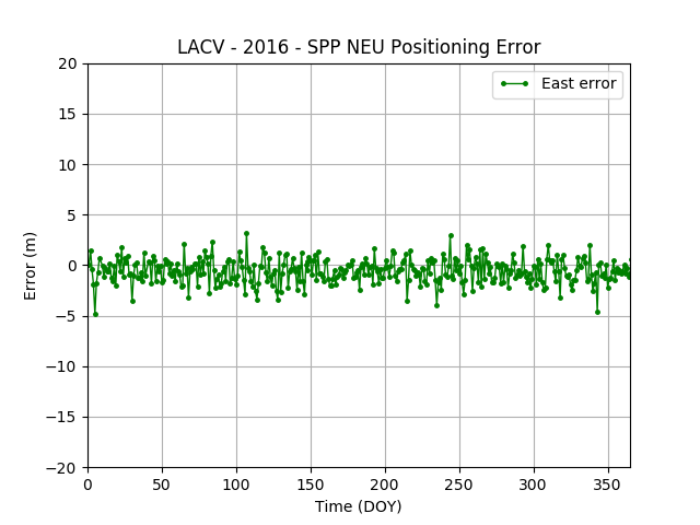
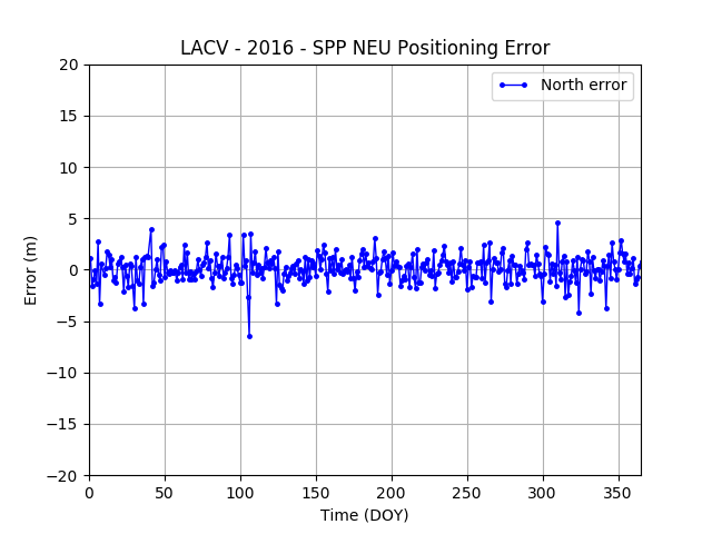
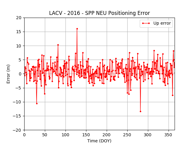
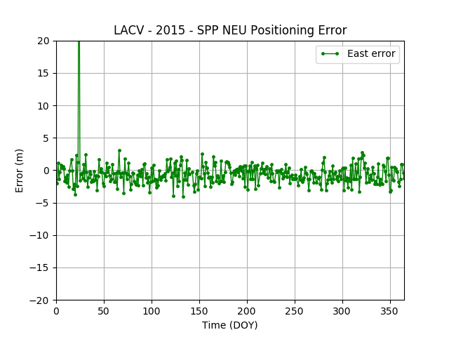
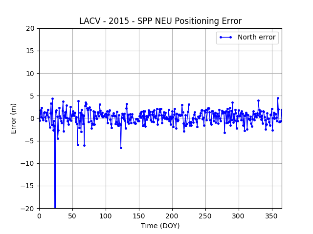
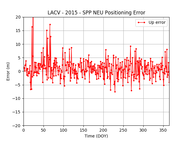
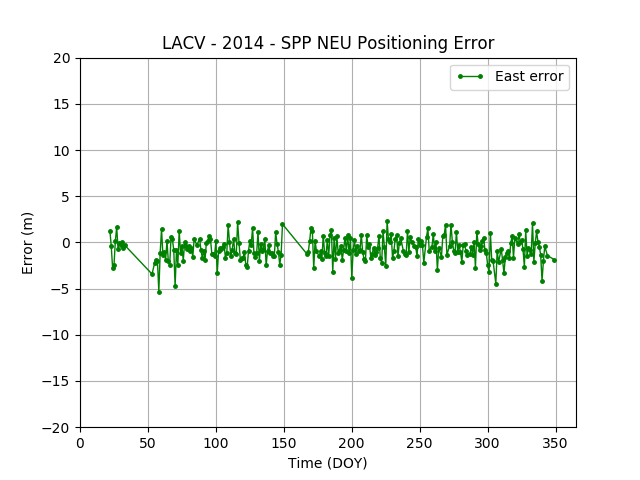
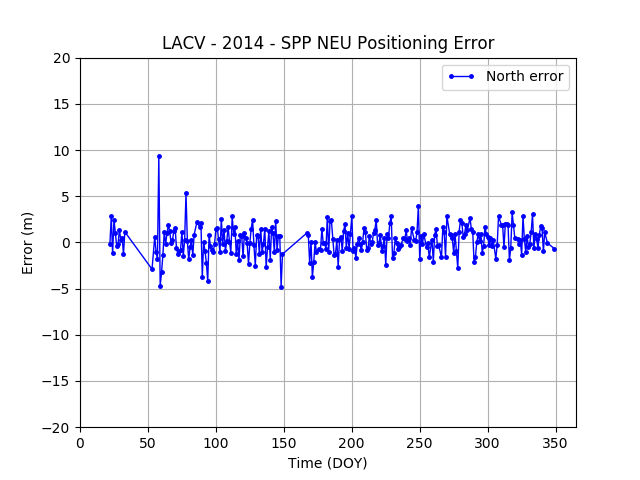
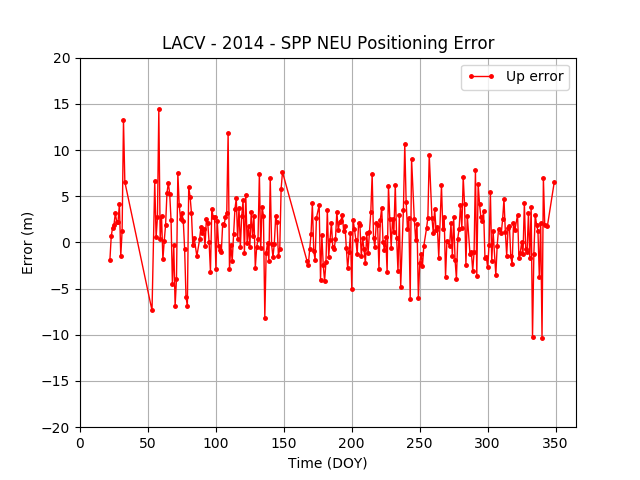
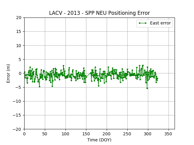
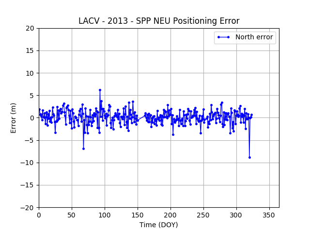
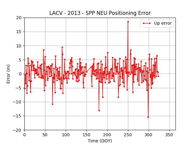
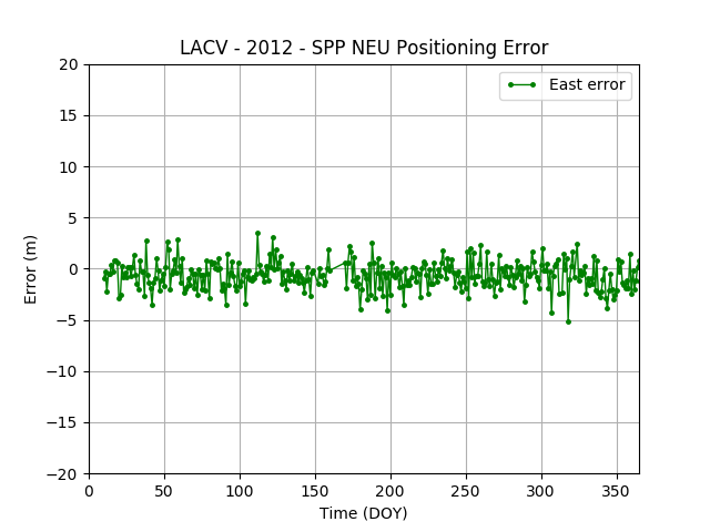
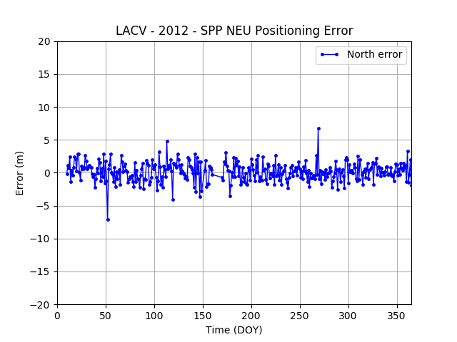
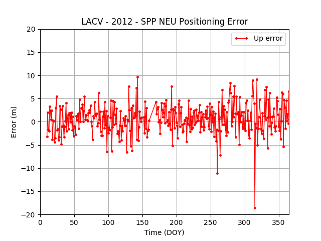
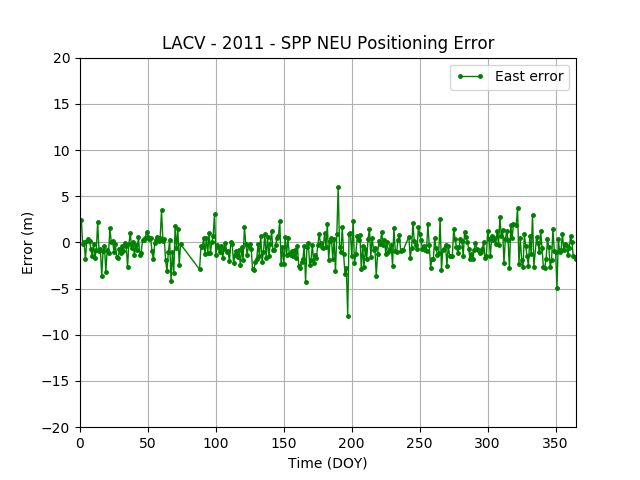
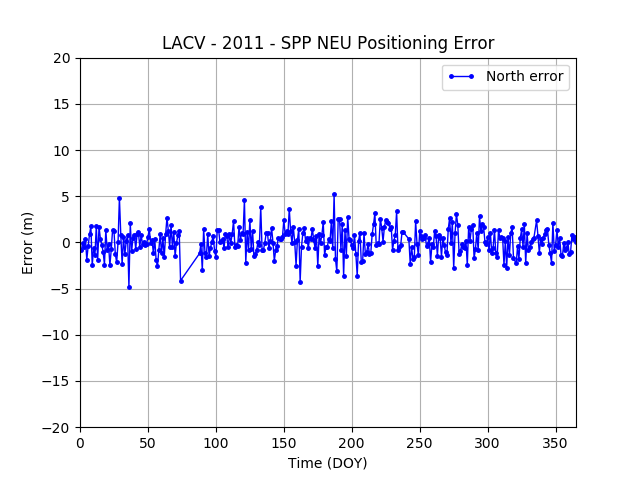
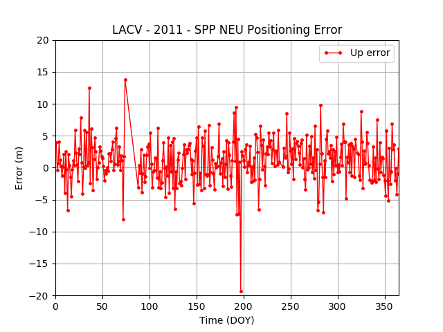
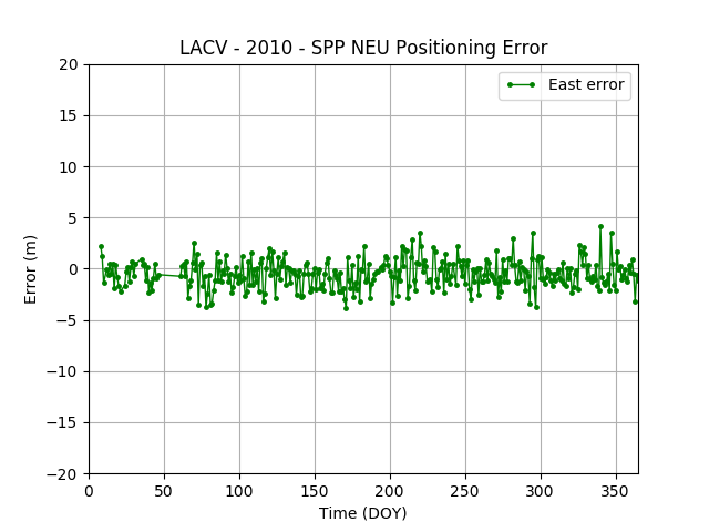
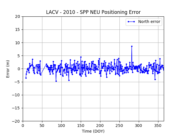
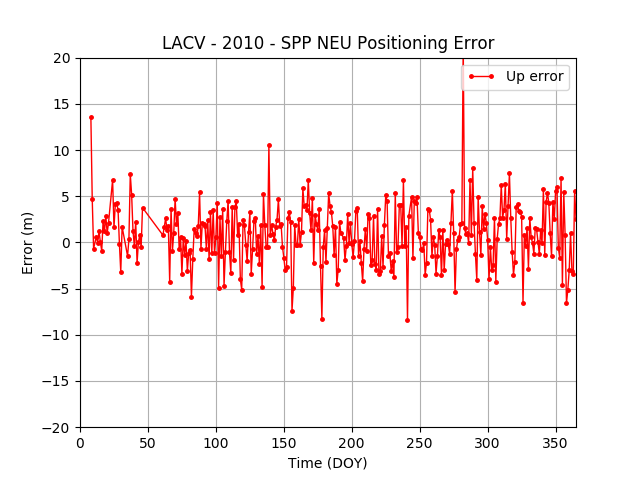
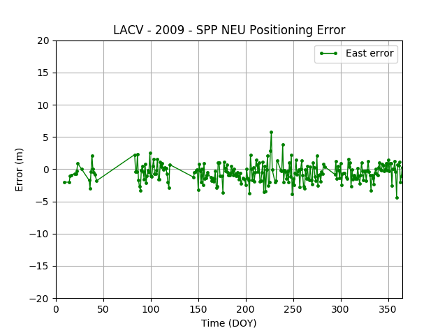
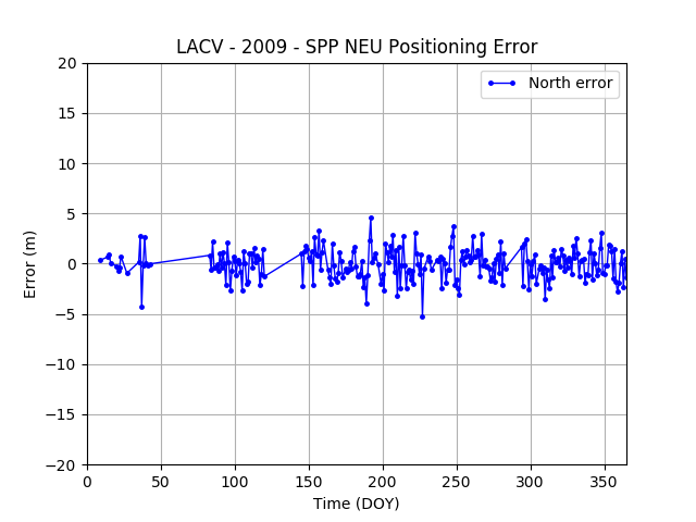
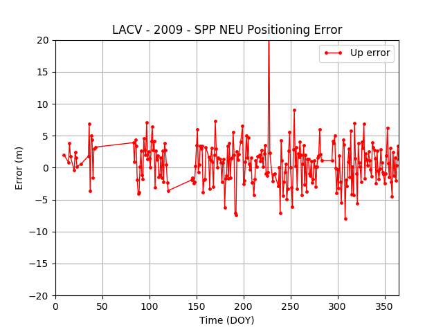
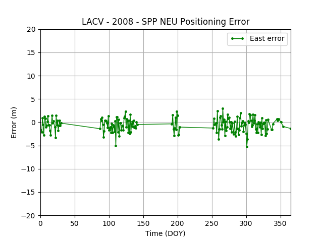
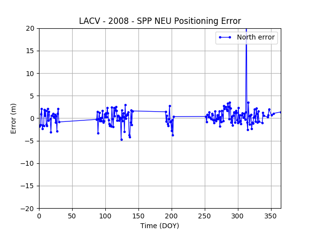
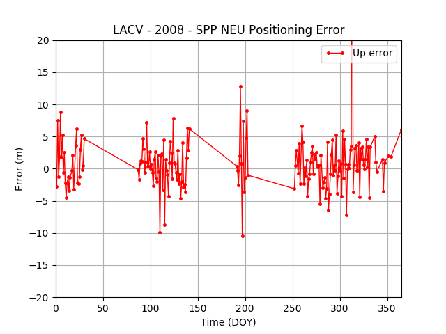
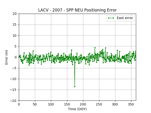
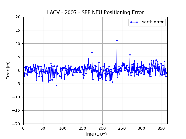
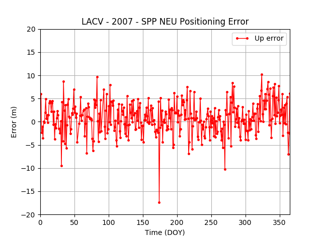
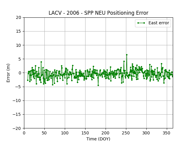
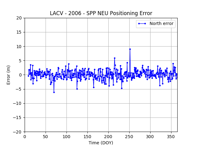
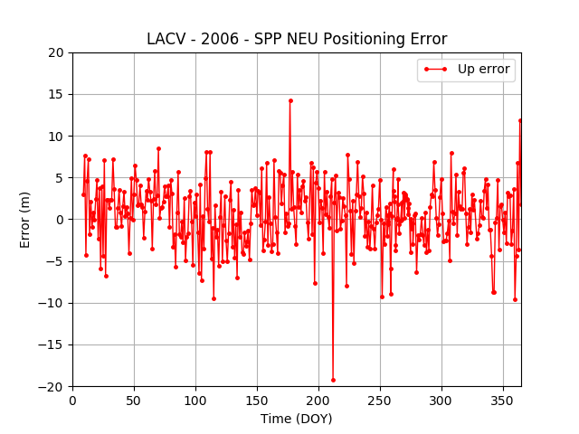
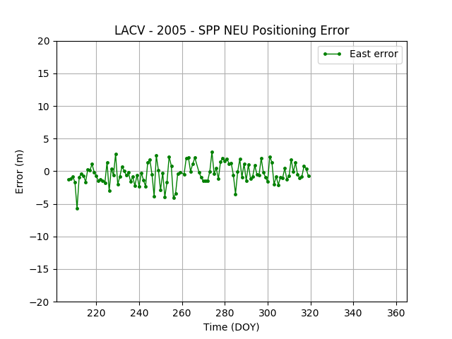
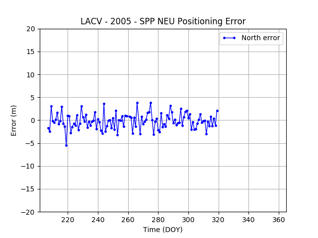
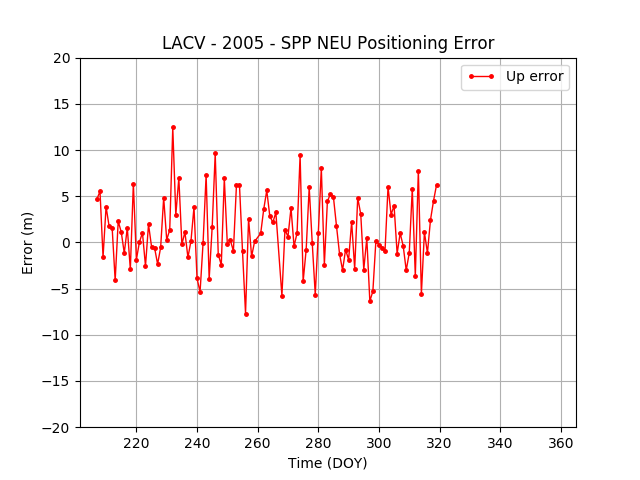
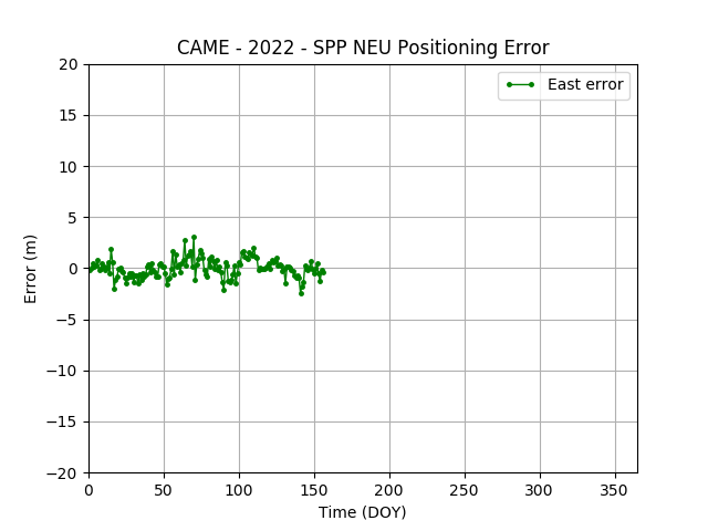
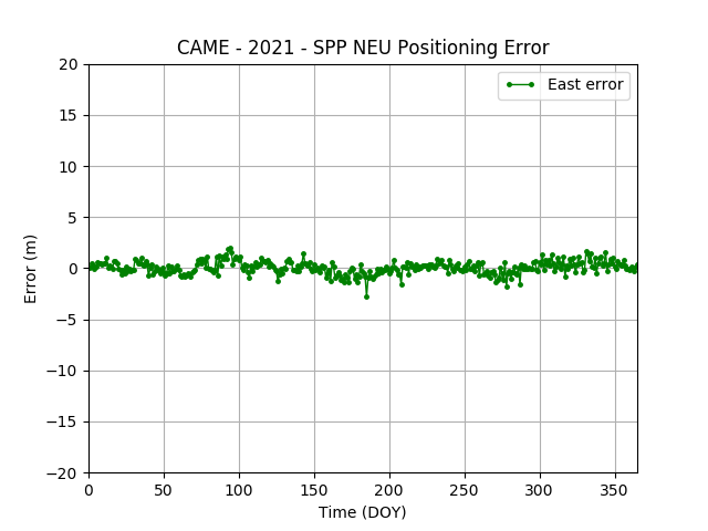
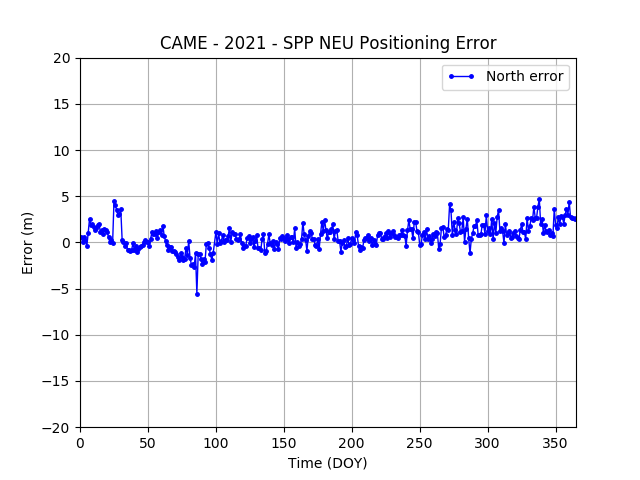
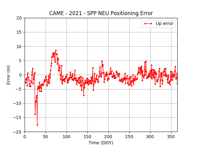
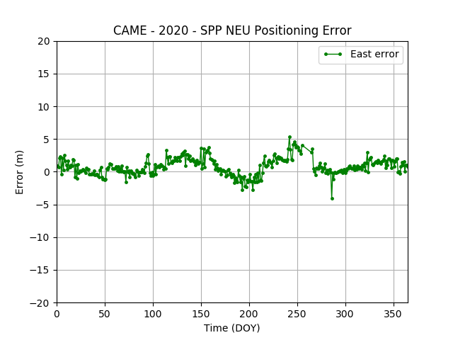
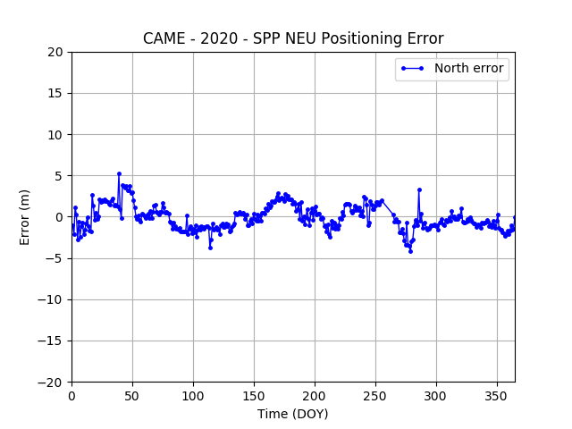
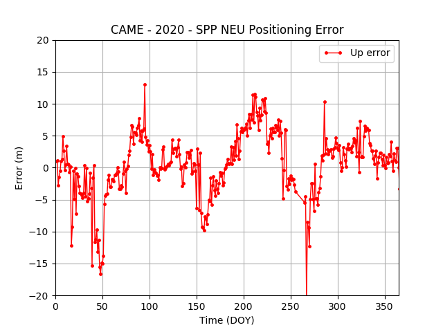
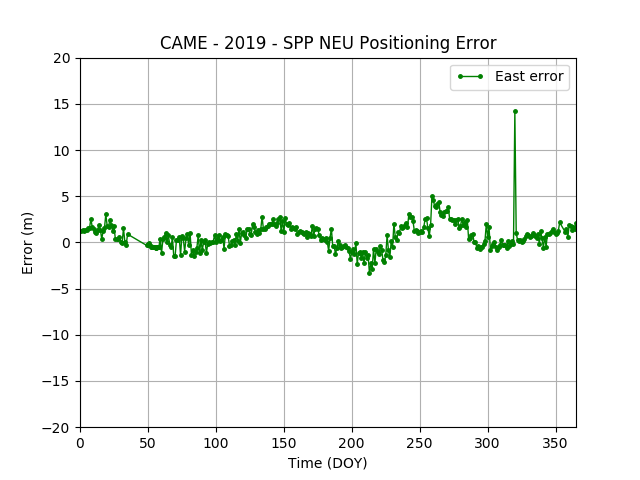
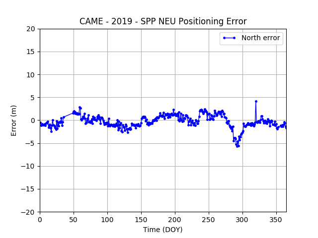
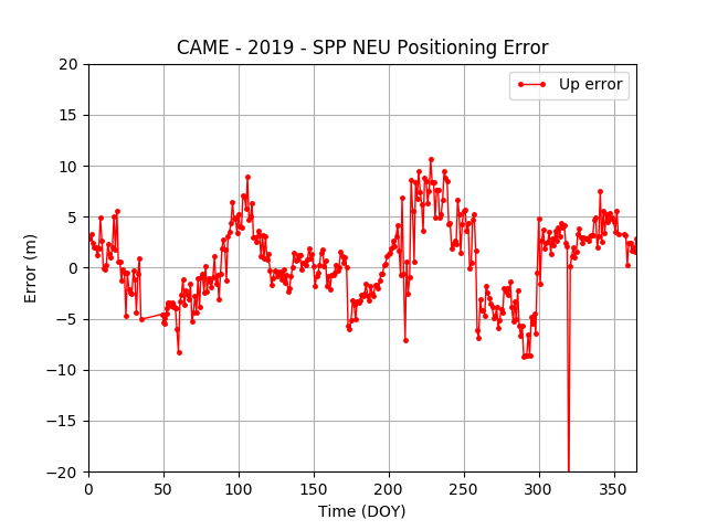
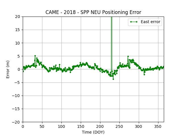
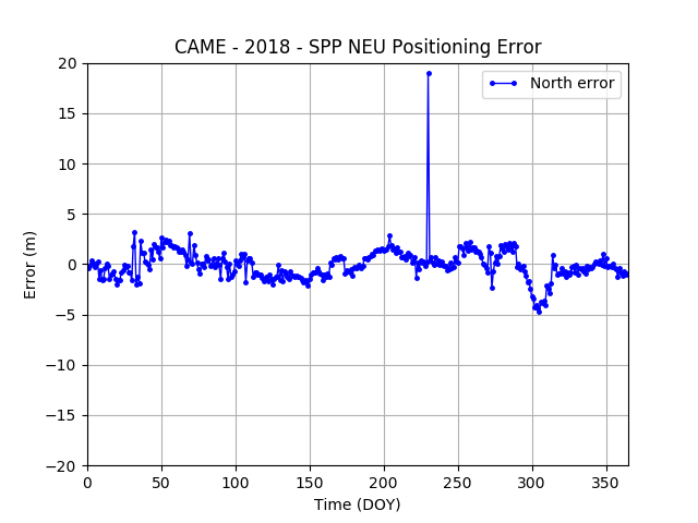
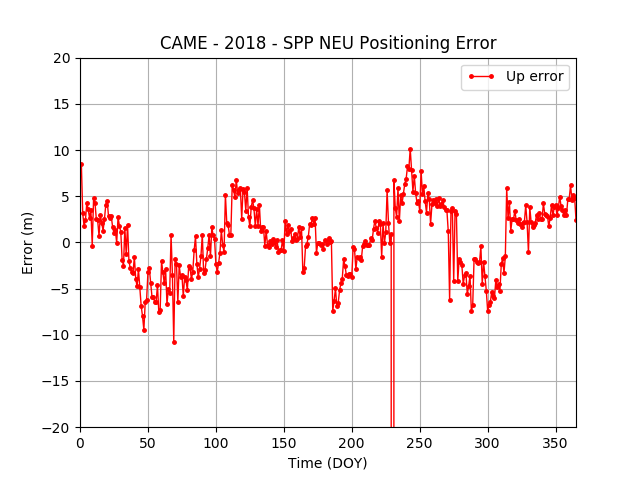
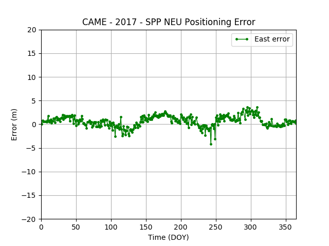
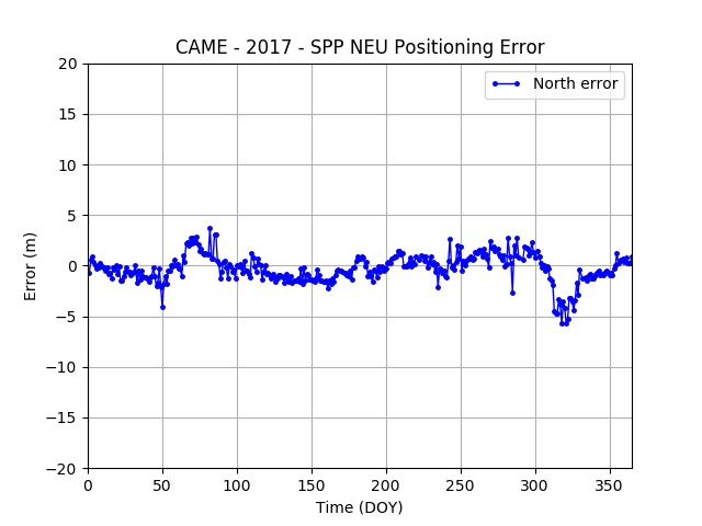
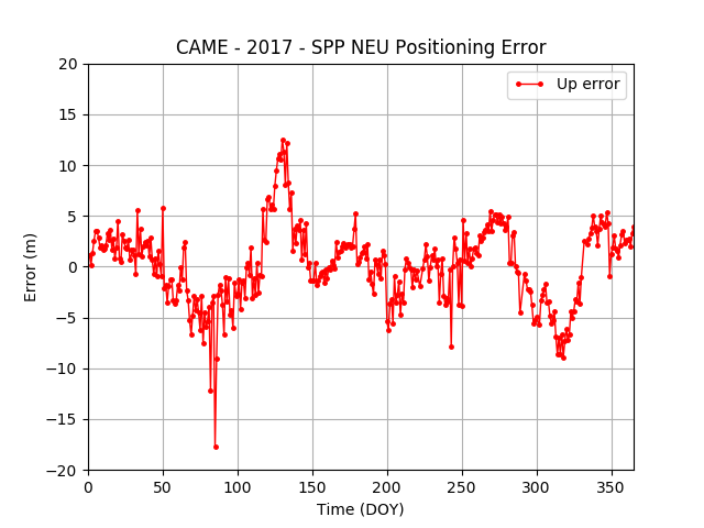
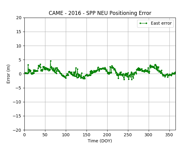
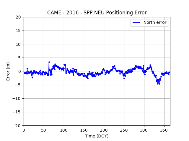
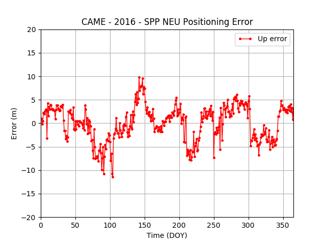
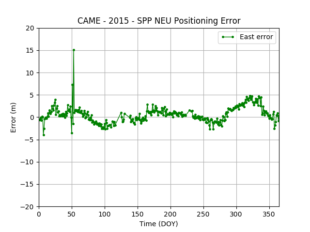
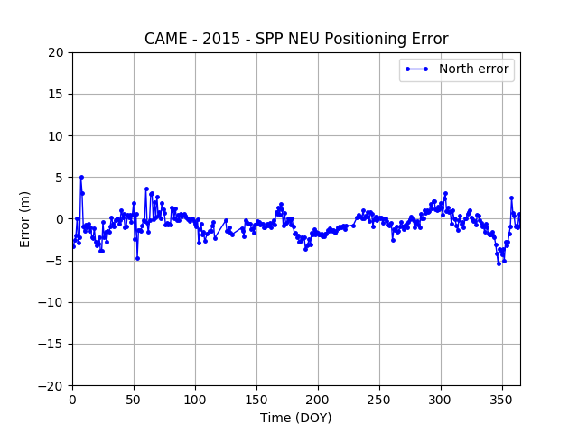
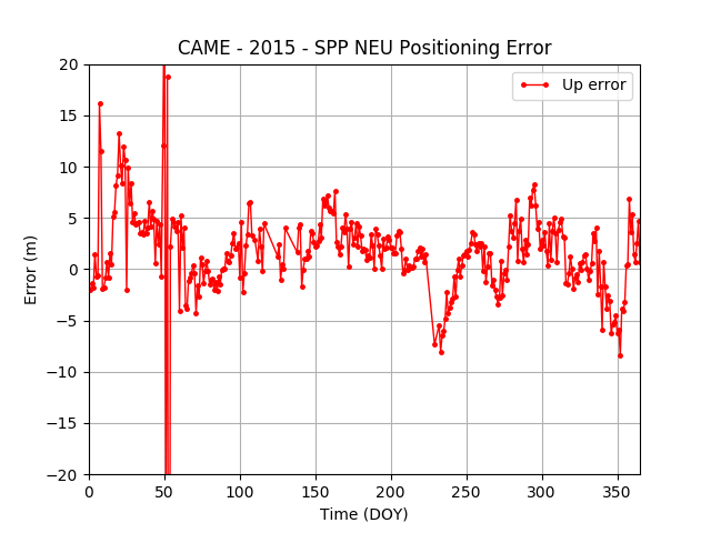
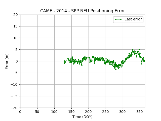
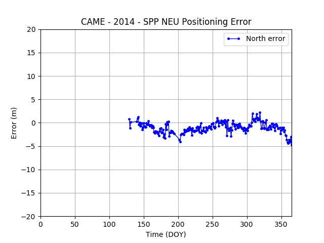
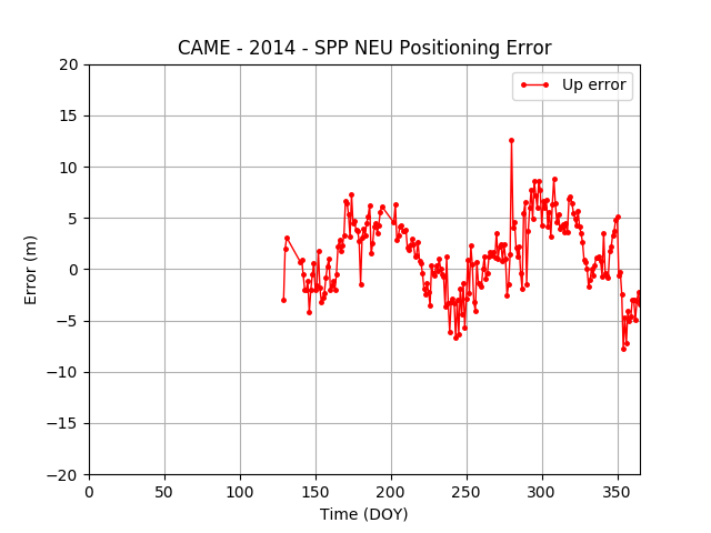
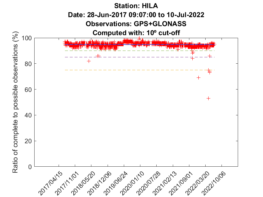
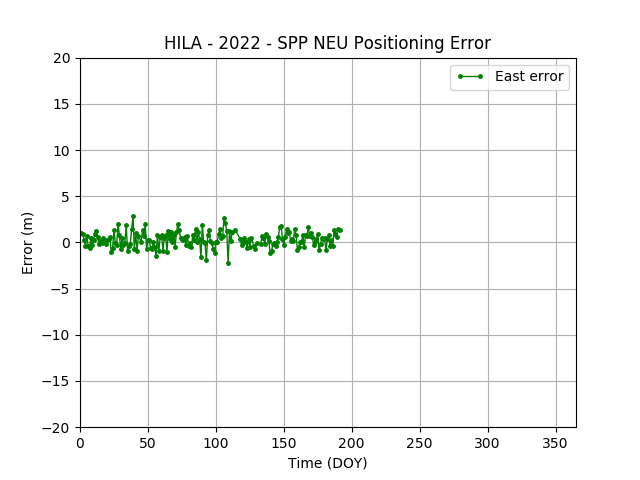
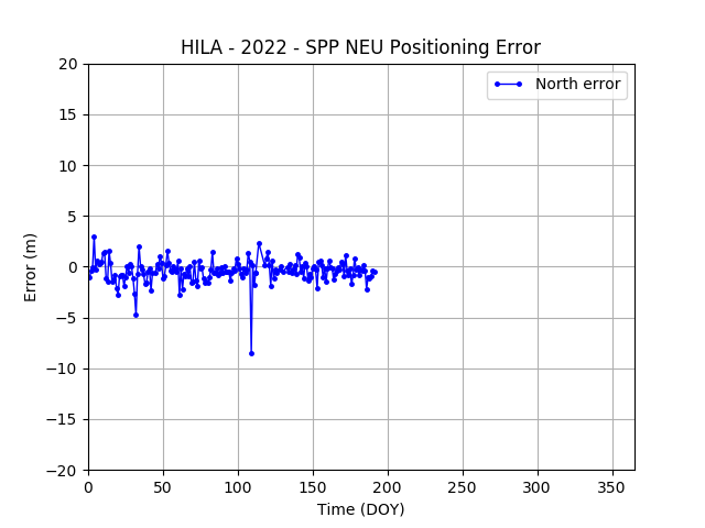
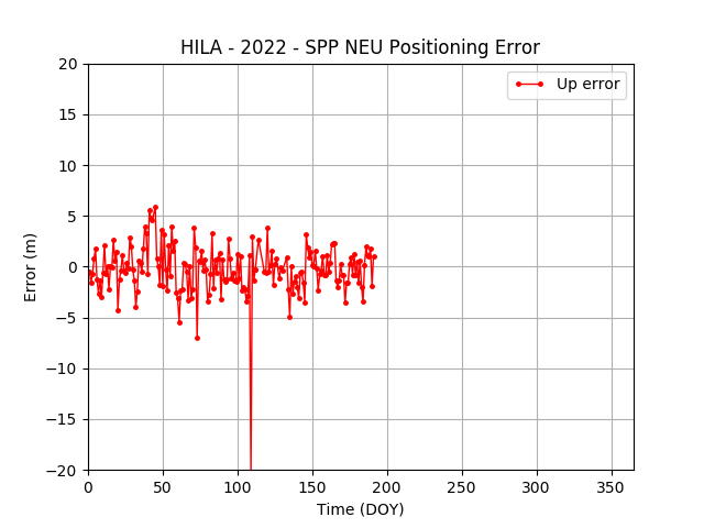
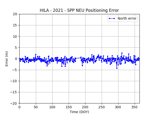
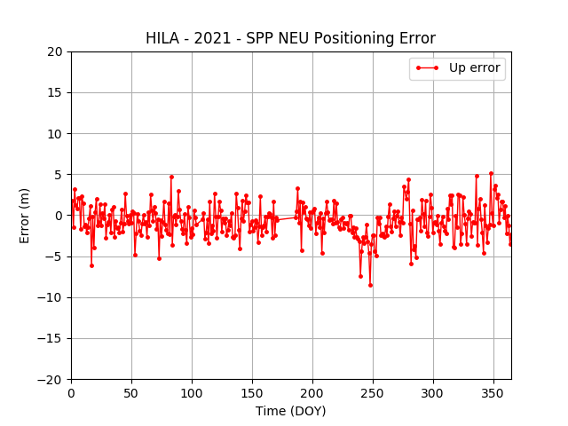
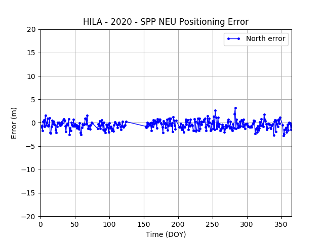
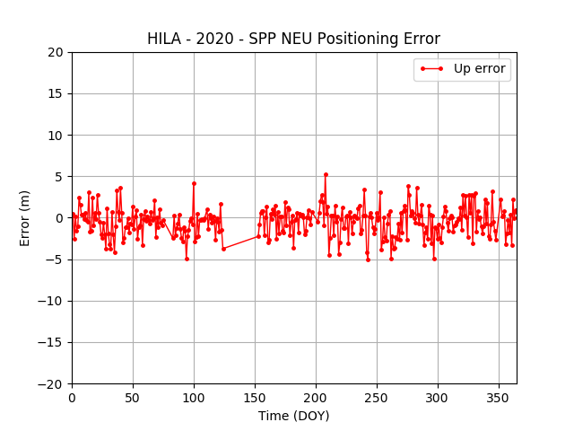
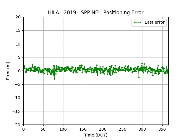
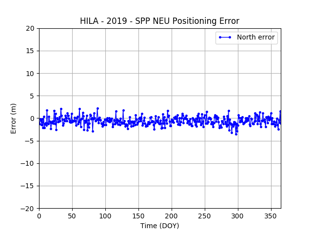
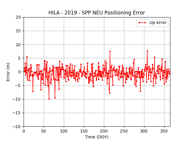
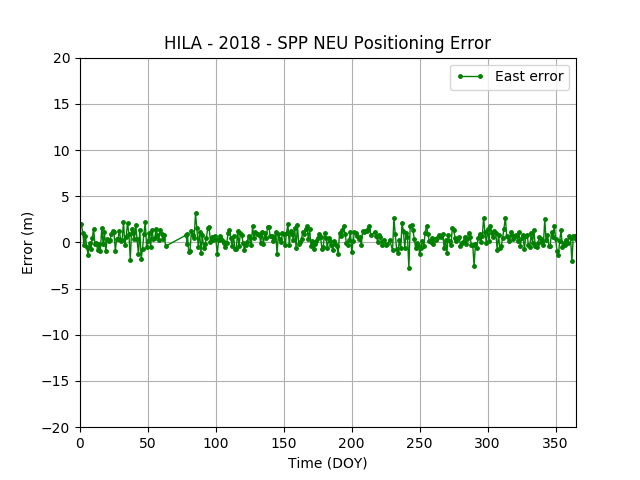
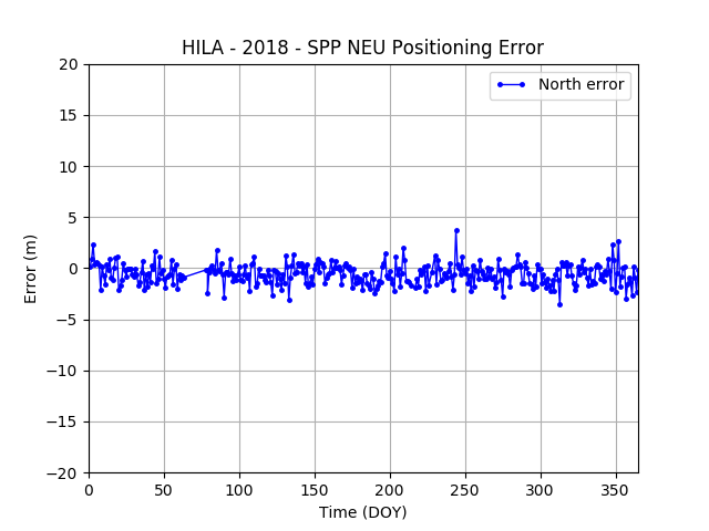
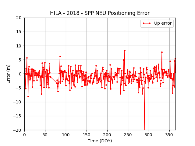
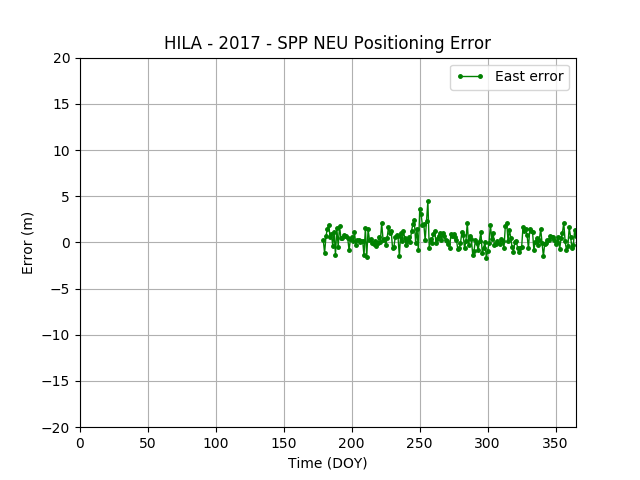
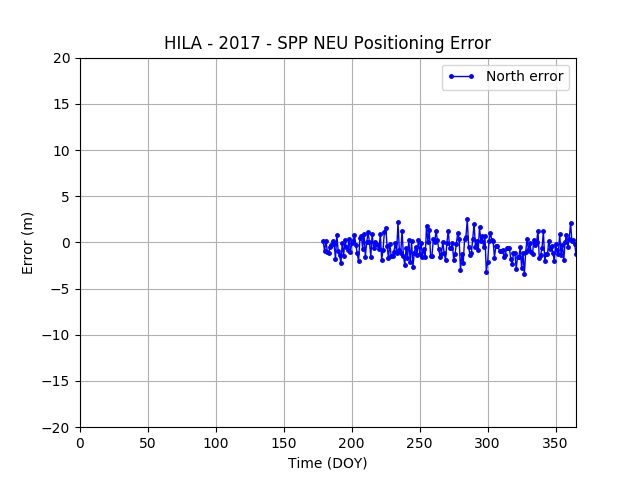
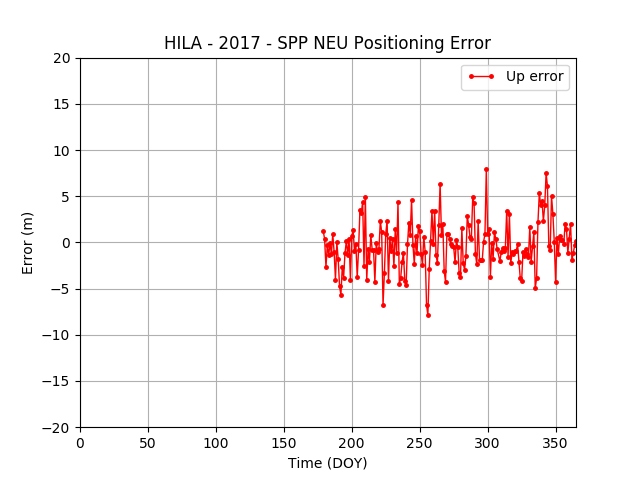
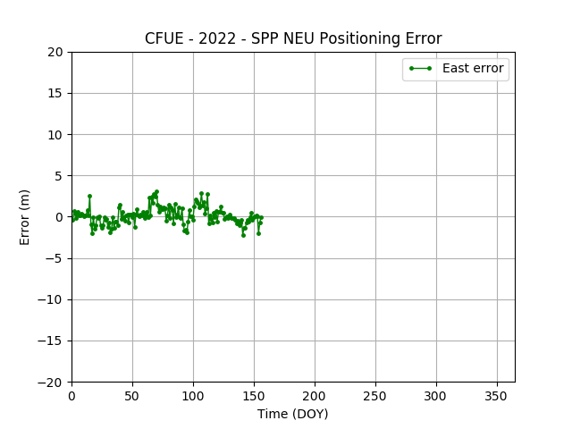
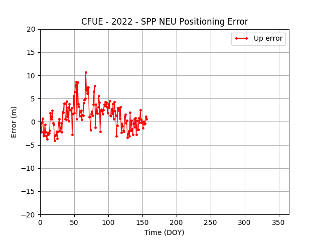
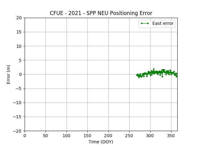
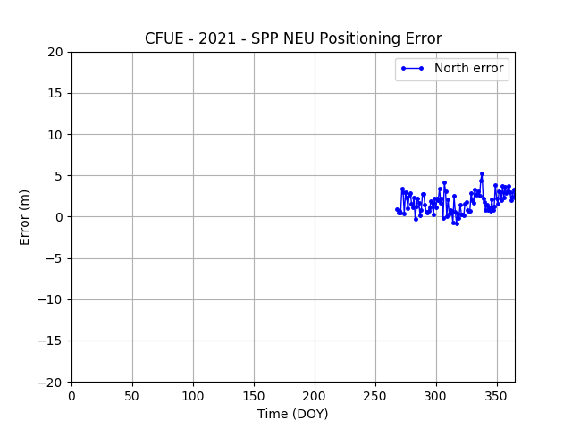
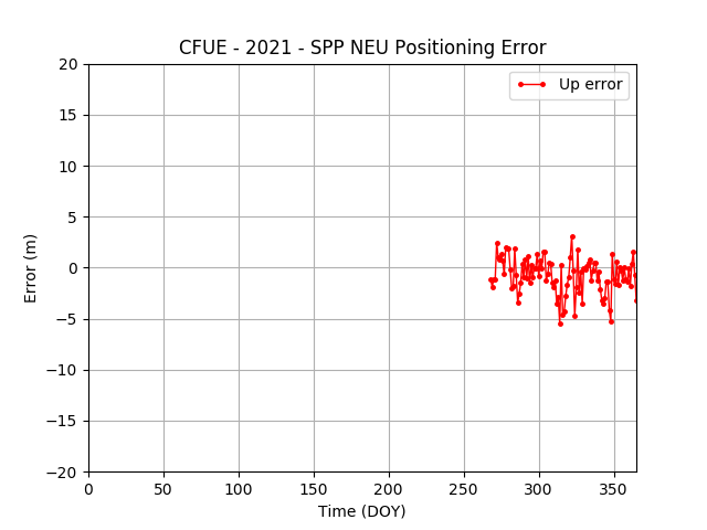
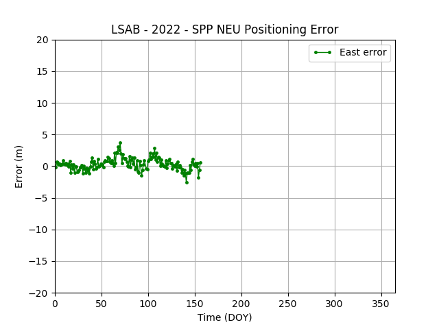
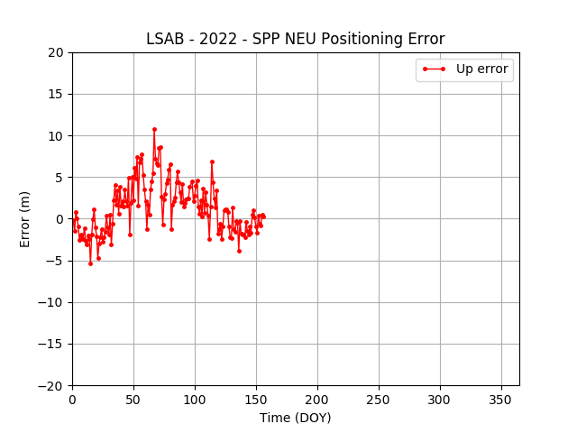
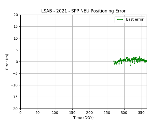
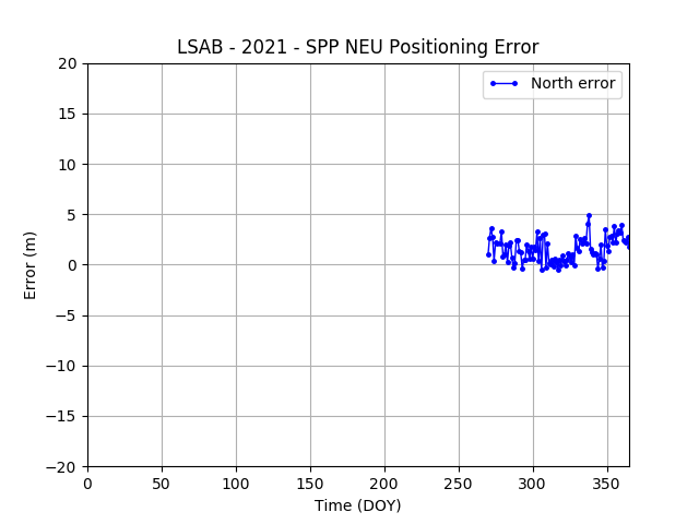
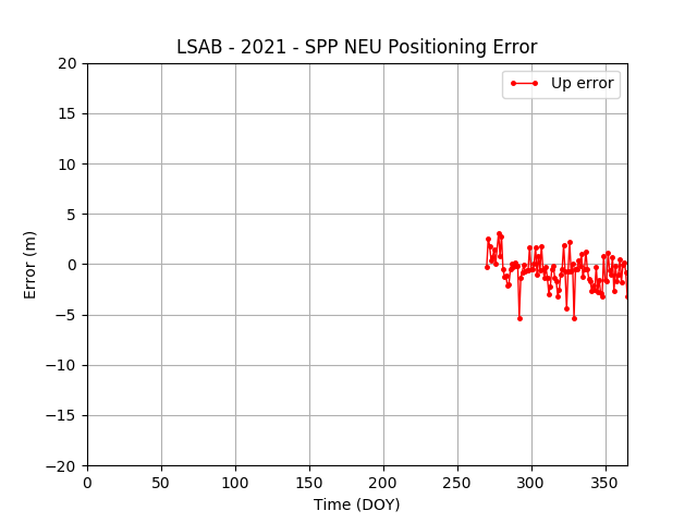
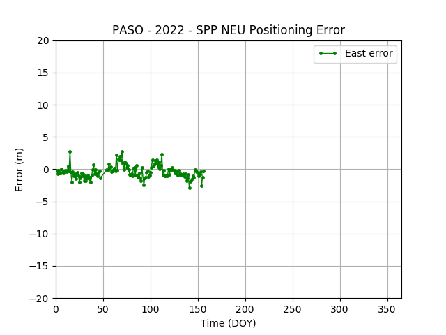
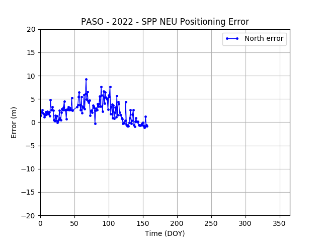
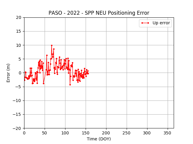
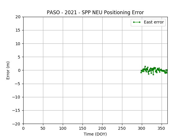
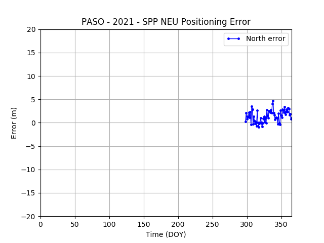
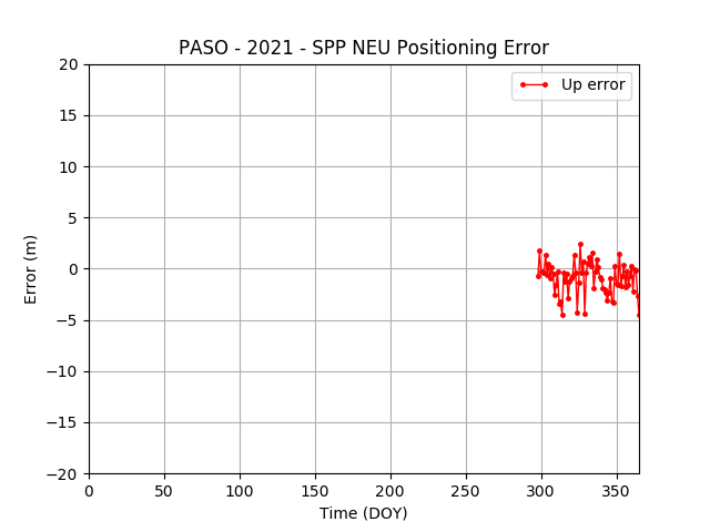
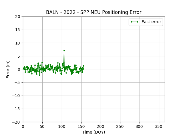
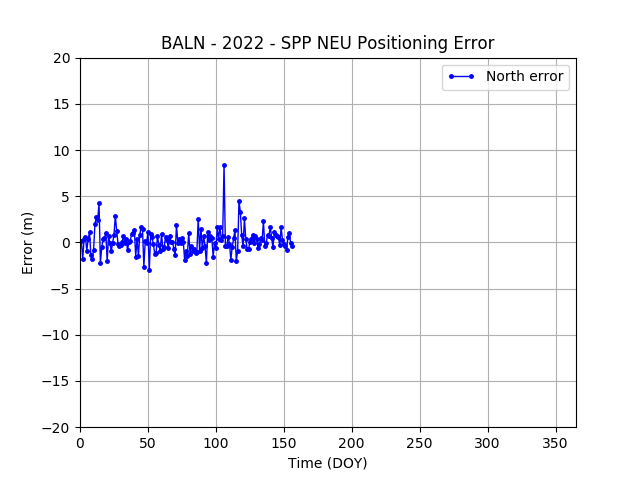
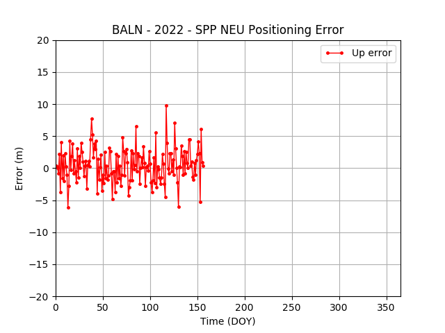
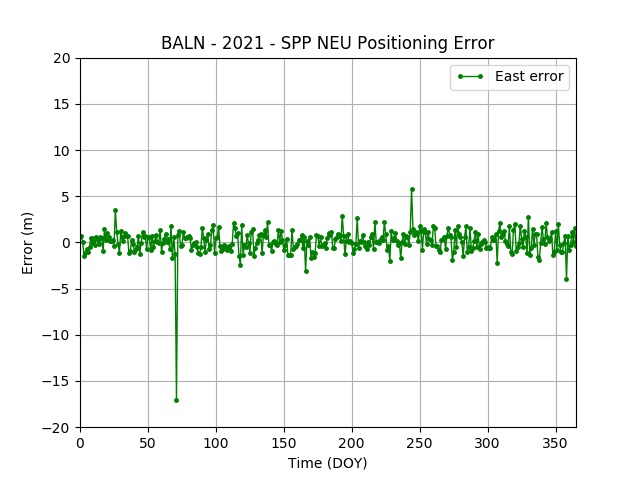
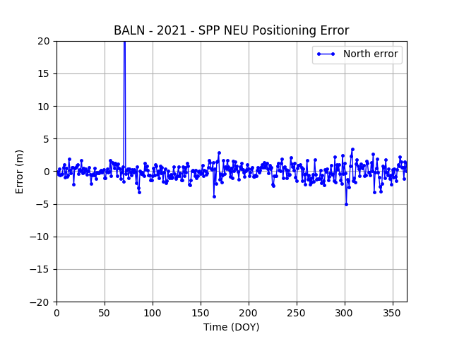
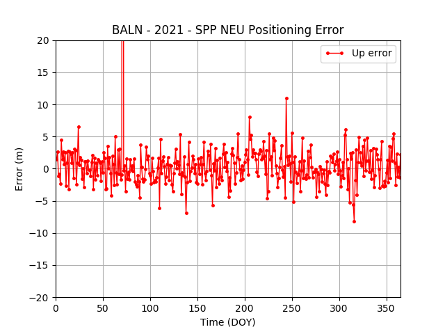
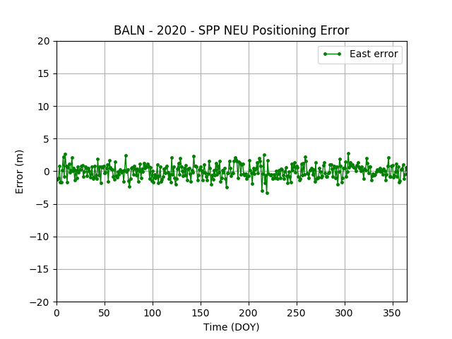
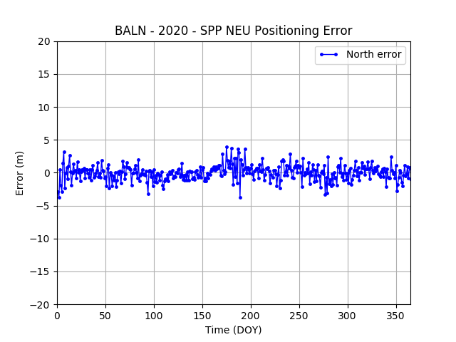
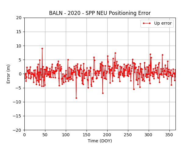
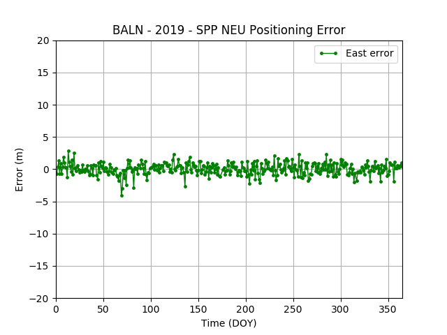
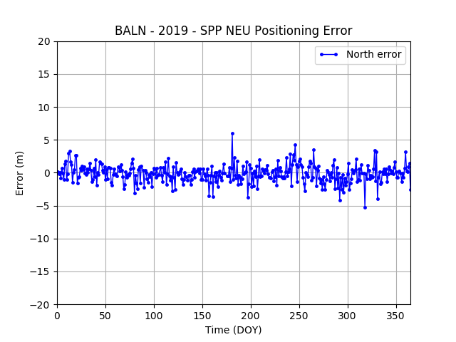
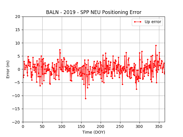
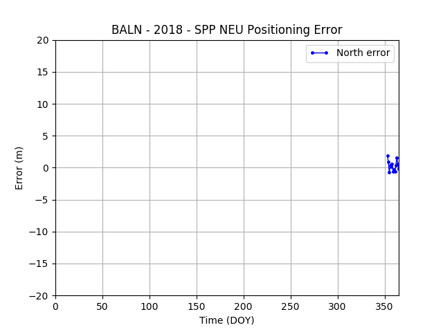
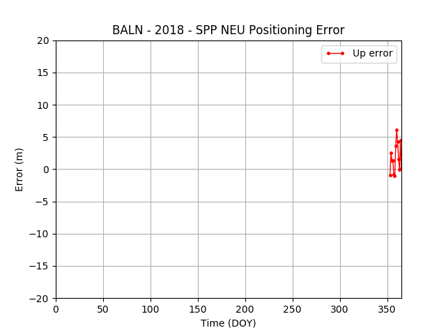
Para el control de la calidad de los datos se ha utilizado el software TEQC (*). Para el análisis de las observaciones se ha utilizado el software gLab v5.4.0 (**). Se ha realizado un procesamiento estandar de las estaciones (SPP - Standard Point Positioning ) a partir de los ficheros de observación y del archivo de mensajes de navegación para el mismo día.
(*) TEQC: The Multi-Purpose Toolkit for GPS/GLONASS Data, L. H. Estey and C. M. Meertens, GPS Solutions (pub. by John Wiley & Sons), Vol. 3, No. 1, pp. 42-49, doi:10.1007/PL00012778, 1999.
(**) Sanz, J.; Rovira-Garcia, Adria.; Hernandez, M.; Juan, J.; Ventura-Traveset, J.; Lopez, C.; Hein, G. The ESA/UPC GNSS-Lab Tool (gLAB): An advanced educational and professional package for GNSS data processing and analysis. 6th ESA Workshop on Satellite Navigation Technologies Multi-GNSS Navigation Technologies. Proceedings ISBN: 978-1-4673-2010-8, DOI: 10.1109/NAVITEC.2012.6423100. Noordwijk, the Netherlands. December 2012.